An element is one kind of thing you can put on a map: a wildflower meadow, gravel turf, a street tree, a retaining wall, a planned tree, a heat hotspot. Every map, sheet, legend and export of the library is drawn from these elements, and every external classification is translated into them.
3.1 What is in it#
| Group | Elements | Examples |
|---|---|---|
vegetation.* |
48 | lawns and meadows, plantings, parks and gardens, woodland and hedges, fields, wetlands, green roofs |
blue_green |
3 | infiltration swale, rain garden, retention basin |
trees |
12 | deciduous, conifer, fruit, street and veteran trees; planned, protected and felled trees; shrubs; tree rows; canopy |
water |
8 | water body, watercourse, ditch, temporary water, pool, mudflat, fountain, spring |
ground |
7 | bare soil, sand, dune, rock, mulch, snow and ice, construction site |
surface.* |
33 | sealed, paved, permeable, loose, sport and rail surfaces; roads, footways, cycleways, squares, parking |
landuse |
10 | residential, mixed, commercial, public, sports, recreation, quarry, landfill, airport, port |
built |
11 | buildings (existing, minor, planned), greenhouse, solar panels, underground structure, steps, bridge, walls |
furniture, ecology |
12 | bench, bin, lamp, bicycle stand, sign, play equipment, artwork, planter, bollard; deadwood, stone pile, nesting aid |
boundary, relief |
10 | site, parcel and plan-area boundaries, fence, kerb, protection zones; contours, embankment |
planning, analysis |
14 | planned/removal status, protected biotope, compensation, planting and preservation areas, habitat corridor, flood zone; sensor, survey point, highlight, heat hotspot, cool spot, no data |
context, other |
5 | grey context for surroundings; unknown for unclassified features |
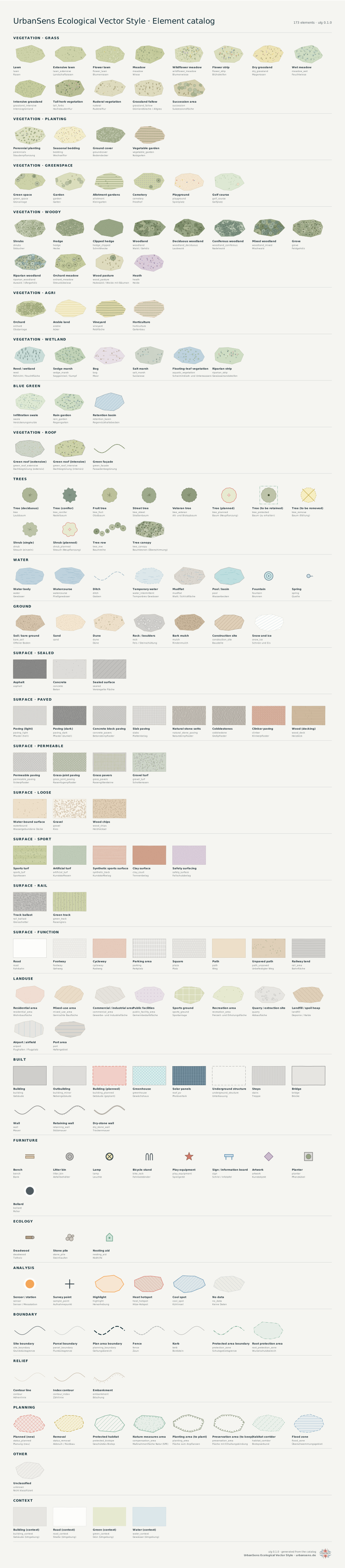
The complete list with ids, English and German names and aliases is reference/element-list.md; every element is drawn on the catalog pages below.
3.2 The pages#
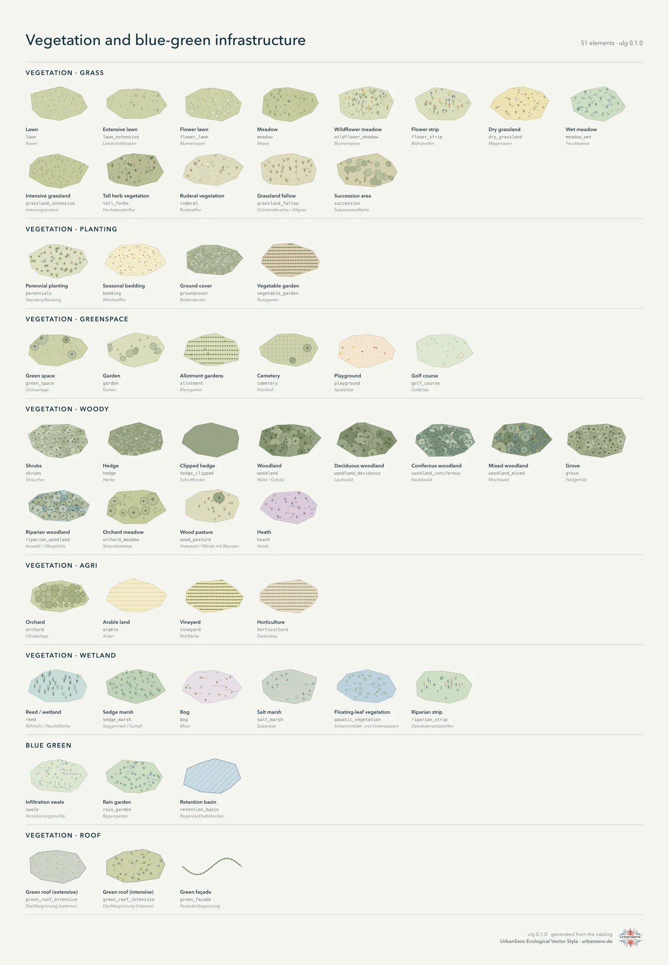
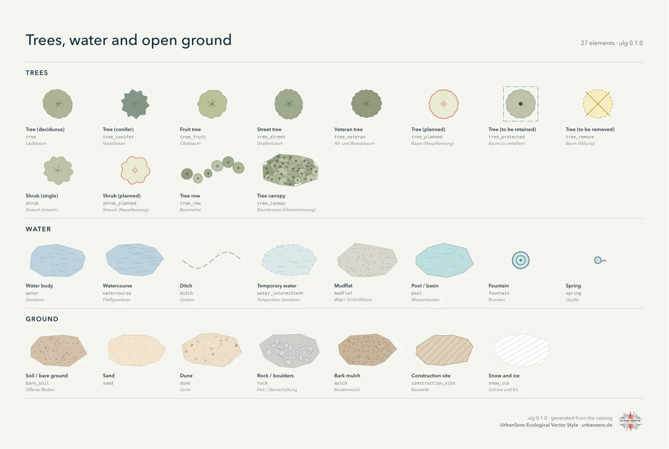
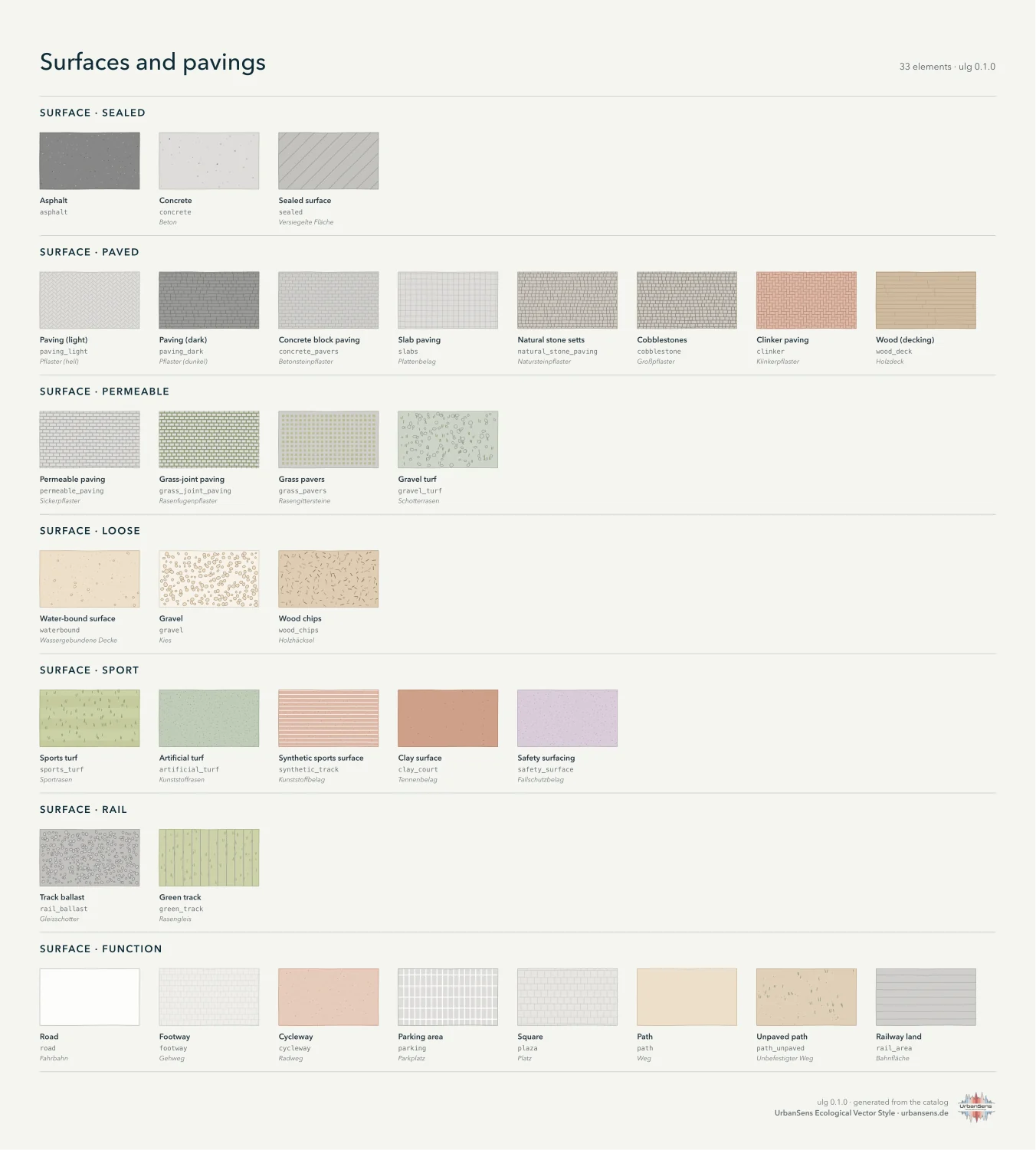
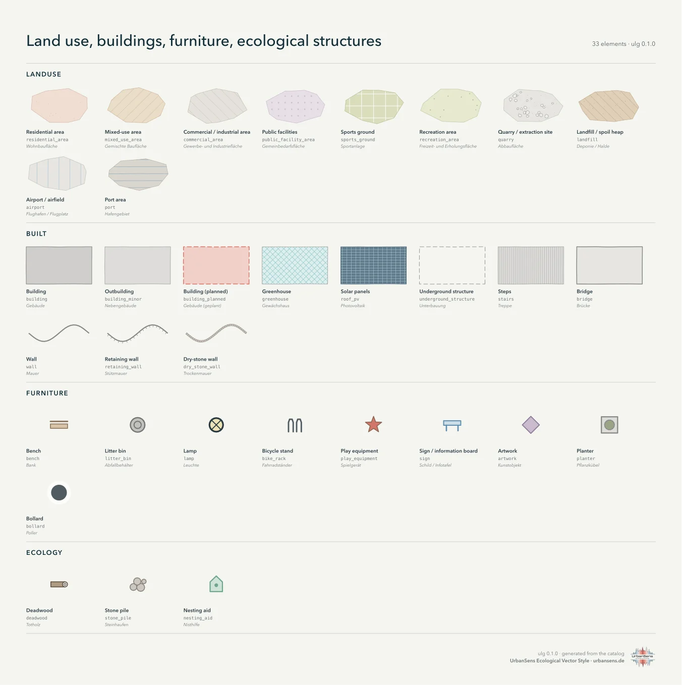
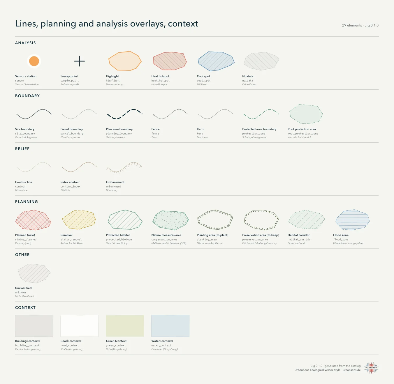
All pages together: img/catalog-sheet.svg (vector, true to size).
Regenerate with ulg sheet --catalog -o catalog.svg or python tools/build_docs.py sheets.
3.3 Anatomy of an element#
Elements live in src/ulg/data/elements/*.json, one file per theme group, keyed by id:
"meadow": {
  "group": "vegetation.grass",
  "geometry": ["polygon"],
  "z": 20,
  "label":       {"en": "Meadow", "de": "Wiese"},
  "description": {"en": "Taller, more diverse grass, mown once or twice a year. Medium biodiversity.",
                  "de": "Höherer, vielfältigerer Bewuchs, ein- bis zweischürig. Mittlere Biodiversität."},
  "fill": "grass.400",
  "wash": true,
  "textures": [{"motif": "grass_tufts", "ink": "grass.700", "ink2": "grass.600"}],
  "attributes": {"sealing": "unsealed", "vegetated": true, "biodiversity": 3, "bdla_class": 1,
                 "bff": 1.0, "bff_1990": 1.0, "runoff_cs": 0.2, "runoff_cm": 0.1,
                 "albedo": 0.18, "emissivity": 0.97, "nrr_urban_green": true, "layer": "ground"},
  "aliases": ["Mähwiese", "Extensivwiese", "Extensivgrünland", "hay meadow", "grassland"]
}
| Field | Meaning |
|---|---|
group |
where the element belongs; the first part (vegetation, surface …) is the family |
geometry |
polygon, line, point: what the element can be drawn from. Area-only elements such as road also accept centre lines, drawn as strips of their width |
z |
drawing band (see style guide 2.7) |
label, description |
English and German, for legends, sheets and search |
fill, outline, fill_opacity, outline_width, outline_dash |
flat look, as palette tokens |
textures |
one or two texture motifs with inks and per-LOD settings |
line |
for line elements: colour, width, dash, casing, marks along the line (ticks, crosses, dots, crowns, hachures) |
symbol |
for points: crown (drawn to scale), dot, or a pictogram (bench, lamp, planter …) |
border |
marks along a polygon edge (PlanZV borders: tees, open circles, filled dots) |
attributes |
standard coefficients and flags, each documented with its source |
aliases |
other names in German and English, used by search and by agents |
In Python:
el = ulg.element("gravel_turf")
el.name("de")          # 'Schotterrasen'
el.fill                # hex colour, resolved from the palette token
el.attributes          # {'sealing': 'partly', 'bdla_class': 3, 'bff': 0.4, 'bff_1990': 0.5, 'runoff_cs': 0.3, 'runoff_cm': 0.2, ...}
ulg.codes_for("wildflower_meadow")   # the classes of other schemes that map onto it
3.4 Attributes: coefficients that travel with the style#
The same id that picks a colour also carries the numbers planners need. Values are copied from
the named sources and never interpolated: a surface without a published value has none, and
ulg.indicators() reports how much of the site had a value (coverage) instead of guessing.
| Attribute | Meaning | Source |
|---|---|---|
sealing |
sealed / partly / unsealed / built | Umweltbundesamt |
bdla_class |
five surface classes of the qualified open-space plan | bdla (2022) |
bff, bff_1990 |
Berlin biotope area factor weights, current list and 1990 list | SenUVK Berlin (2021), BFF report (1990) |
runoff_cm, runoff_cs |
mean and peak runoff coefficients | DIN 1986-100:2016-12, Table 9 (via a municipal reproduction) |
albedo, emissivity |
radiative properties for microclimate models | PALM model system 6.0 tables |
belagsklasse |
Berlin paving impact classes | Berlin Umweltatlas 01.02 |
nrr_urban_green |
counts as urban green space under the EU Nature Restoration Regulation | Regulation (EU) 2024/1991, Art. 3(20) and the Copernicus data it names |
canopy, layer, is_complex, vegetated, water |
flags used by the indicators and the drawing order | house |
biodiversity |
rough 1–5 heuristic for quick maps and legend order, not a valuation | house |
Full table per element: reference/attributes.md.
Layers. layer: ground elements tile the site (land cover). layer: roof elements (green roofs,
solar panels) lie on buildings and replace the building surface in runoff and albedo; they add their
BFF credit on top. layer: overlay elements (boundaries, planning and analysis overlays, tree canopy)
are drawn over everything and never counted as area.
Complexes. Elements with is_complex (residential area, park, cemetery, allotments, airport …)
stand for a whole site with its internal surfaces. Map either the complex or its parts; if you map
both, the parts are drawn on top and ulg.flatten() gives each square metre to the part.
3.5 Finding the right element#
ulg.find("Schotterrasen")      # [gravel_turf, lawn, gravel, wood_deck]
ulg.find("Rasengitter")        # [grass_pavers, grass_joint_paving]
ulg.resolve("osm", highway="footway", surface="compacted")    # 'waterbound'
ulg find Blumenwiese
ulg show wildflower_meadow --json
ulg list --group surface
Search looks at ids, English and German names and all aliases. If nothing fits, the feature should
become unknown (drawn as a neutral hatch) until an element is added, see
Extending.